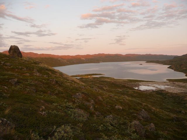
Day 2
| 23h30 : I'm awake... I want to walk ! One understand here that "Day" means a "physiological" day, given that it is still officially D1. Please throw your landmarks and circadian clocks away, you are on the polar circle. During the time I spend lying in bed, some people cross the place. I hear a big bird flying over my tent. This event put an end to my hesitation. I take the tent down. 1.30. I cross the river, and put my shoes. They are almost dry despite the swamps of yesterday. This point of the hike is a symbolic step. We put the "Kangerlussuaq" map away and take the "Pingu" map... a map representing 2400 km2 without town, without village, without settlement. Wilderness. I reach the two hikers who crossed the place. They are Greenlandic. I ask them information about the bird which flew above my tent... it was a duck. I'm a bit desapointed not to see a bird that was so close to my tent. I think that they took me for a silly person to focus my questions on a bird. However, they also enjoy wild animals. They have been followed by a raindeer. |
 |
|
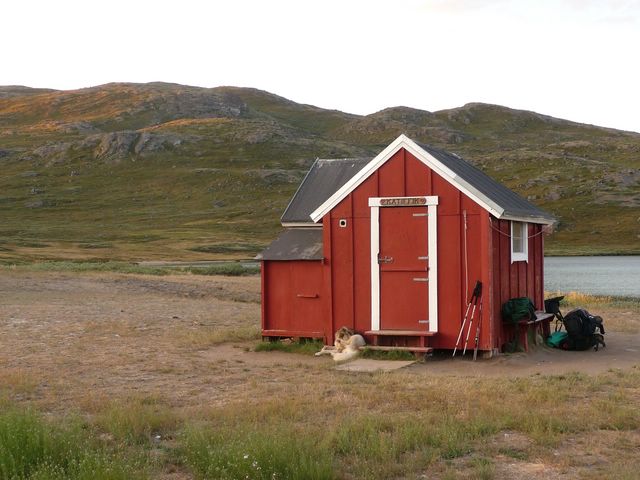
I continue my way, loose the track and uses the map to reach the next hut. I climb back in the willows, in arctic billberry plants, and in a marvelously smelling plant, but which I fail to identify. A slightly resined smell. 3.35. I am to the hut. It was the second-chance hut: two canoes are lying here. But there are three tents, people in the hut, and a dog attached near the door. According to the Americans crossed yesterday, only the two who passed near the tent may hope a canoe for the next day. The others probably go in the other direction. But it is possible that the two Greenlandic also expect to take a canoe. I should take a decision: the wind is favorable and may turn... |
|
|
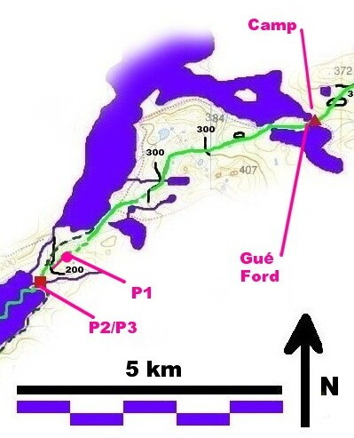
P1: Descent on the Amitsorsuaq lake (3.00 a.m.) |
 |
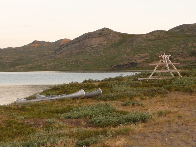 |
| P2 : The hut at the East of Amitsorsuaq lake. | P3 : The canoes, waiting for travelers. |
The two Greenlandics arrive soon after me. I ask them what they expect to do. They have walked during 10 hours, they would like to sleep, but the idea of crossing the 20 next km with a canoe seems to tempt them. After a short discussion Tuuma and Belinda choose to embark, but Tuuma is not sure of his competencies of seaman. So, he will leave me the place of cox.
I must say that I knew that I could bring everybody safely on the other side, i.e. what to avoid to do on this kind of unstable boat, but my ability to keep the straightness of the course was weak. In fact, Tuuma and Belinda were largely so skilful as me in this science... Indeed, it is Tuuma who speeded us to start because the wind was favorable, and Belinda knew what to avoid to do to avoid capsizing. One should note that capsizing is completely forbidden in this deep and cold water.
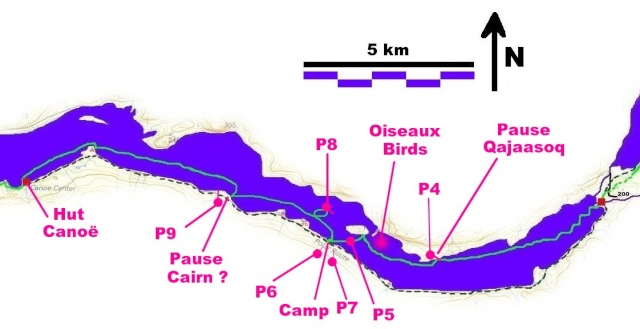
Crossing of the Amitsorsuaq lake. I'm not sure of the location of the "cairn pause".I did not take the GPS coordinates. Pictures and time table suggest that the cairn is located as shown on the map above. However, two capes on the East, a "special monument" is indicated. I first though that it indicated the cairn...
4.00. We "weigh anchor". Our course is so straight as the course of a skier in a slalom competition, but the distance with the hut increases. One hour later, we begin to stabilize the direction.
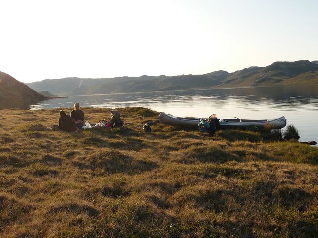
After two hours navigation, we do a stop to eat a bit. There, Belinda takes from her bag the perfumed plant to make an infusion. The Greelandic name is "Qajaasoq"; in English, it is Greenland Labrador-tea. I begin to learn my first Greenlandic words.
We leave this beautiful place 20 mn later. Then navigation is embellished by "great northern divers" and other bird songs.
 |
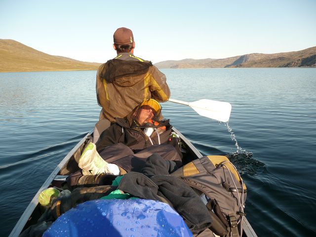 |
| P4 : Qajaasoq Pause | P5 : Ferry boat : "de luxe" cabin. |
Water is deep and clear. Belinda shows us arctic hares running on the slopes of the North bank.
A bit later she asks to stop. She's falling asleep. This is somewhat dangerous on this kind of ship. We stop a couple of minutes to allow her to move and sleep safely.
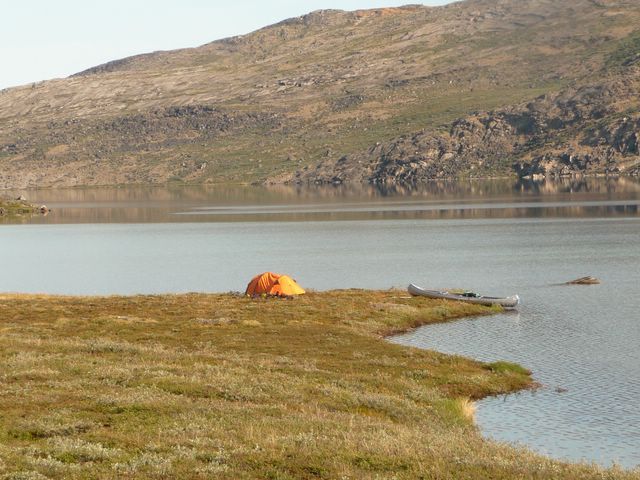
At 8.15, Tuuma is also falling asleep. I feel a bit responsible to embark after 10 h of walk. We reach the South bank and build the tent. We are not in a hurry, and it would be a pity to forget to enjoy life in this beautiful navigation.
Tuuma lend me his fishing tools and proposes me to use his rifle. I'm not used to this kind of tool. I just will try to fish and use my camera for hunting.
I also rapidly understand that I'm not skilled in using only a thread and a hook in order to fish. I throw the hook, but only reach 5 m in a 20 cm deep water. I don't speak about the risk of catching one of my ears or eyes.
The third throw is a success but the hook catch a root. So, I go into the water to get it back and take my camera and my MD recorder. Some great northern divers are singing. On the other side of the lake the other canoe overtakes us with 3 persons on board.
 |
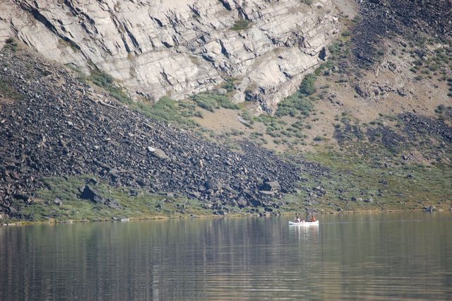 |
| P6 : The resting camp. | P7 : Germans are overtaking us. |
Finally, I take a rest in a bed of qajaasoq (Greenland Labrador-tea).
The warmness of the sun on the tent wakes up Tuuma et Belinda. I forget to show them how to open the tent windows, but anyway, they would have benefited of only 1/2 h extra rest.
Belinda et Tuuma want to guest me for lunch. We eat. They offer me a "Kigutigit" water-bottle because they remark that I bought syrups only to get bottles.
We leave this place at about 11.45.
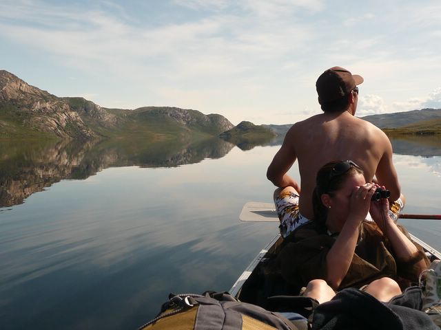 |
| P8 : Fishing on the lake |
Then, we paddle up to the center of the lake to try to catch some fish, without success. A bit later, we stop to watch a giant cairn.
After a short intermediate landing (Belinda replaces Tuuma on paddling), we see two persons walking without bag on the South bank. We conclude that they are spending some days to the next hut and that they are strolling along the lake.
In fact they were sleeping in a tent near the last hut and were expecting to take our canoe. The three persons (Germans) in the second canoe were carrying their bags.
15.30. We arrive to the next hut that is an important canoe center. Some hikers are swimming near the beach, but the weather begins to be cold.
We empty the canoe, pull it on the beach. About at this moment, the wind change of direction... We are luky.
|
|
| P9 : The Amitsorsuaq lake. View from the cairn. |
Tuuma et Belinda will stay sleeping in the hut. I will take benefit of the low temperature to go farther. Moreover, my legs almost did not work today and are therefore full of energy.
I put my walking shoes, link my beach sandals to the bag. My two friends indicate me the location of new huts, not mentioned on the map.
At the time of separation, Belinda hold out her hand in a Nordic/East Europa fashion to shake my hand. As a typical South-West Frenchman, I find this form of greeting very "distant" and sad to greet friends.
Possibly, she understood that, but I've the feeling that she and Tuuma do not like this kind of "cold" greetings more than me, especially after the beautiful day that we spent together.
So, they teach me the Greenlandic way of greeting, which is a warm and loving embrace.
Somewhat sad, as when you leave friends who you are not sure to see again, I proceed on my way.
| The walk between the canoe centre and the Kangerluatsiarsuaq lake (NW of the camp) is easy. The track is well traced along the lake. Conversely to the indication of the map, I don't remember that I have crossed the river. The track does not exist after the lake, but the itinerary is easy to find, following the valley, and with few bogs. | 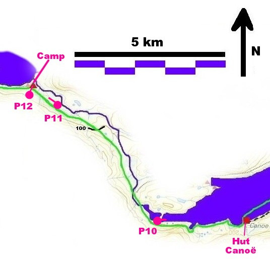 |
 |
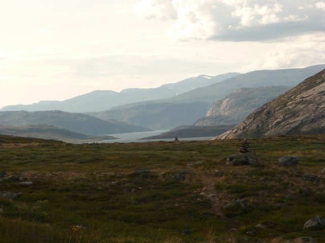 |
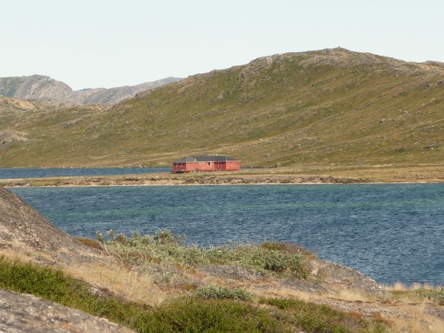
| P10: The canoe centre. View from the West. | P11: Arrival on Kangerluatsiarsuaq lake (from the East) |
|
One or two km after the end of the lake, a raindeer crosses my road. But I miss to take a picture. The raindeer is too fast for me. Four hours of walk after the canoe centre (20h), I pass the central fold of the Pingu map and build the tent near the Kangerluatsiarsuaq lake. |
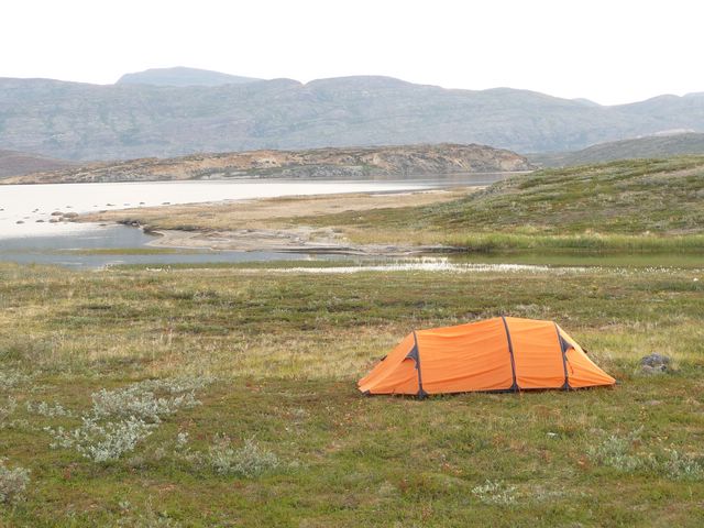 |
| P12: The camp near the Kangerluatsiarsuaq lake |
Back to the "Trek main page", Day 1, Day 2, Day 3, Day 4, Day 5, Day 6

