
Day 4
|
|
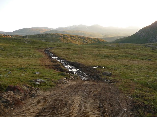
3.00. I finish the dinner of the last evening and leave at 3.45 to begin with courage, the ascension, classified as "black" on the map (Iluliumanersuup Portomga plateau)... I cross the ford and begin to walk on a track... suitable for motor vehicles. A bit annoyed, I find and take the old foot-path, and cross a vehicle. Greetings with the men of the vehicle. I finish the terrible ascension on the track; the foot-path doesn't exist anymore. Follow the track, I miss (like many other hikers) the beginning of the path and use the North hillside to come back on the actual path 2 km farther. |

 |
 |
 |
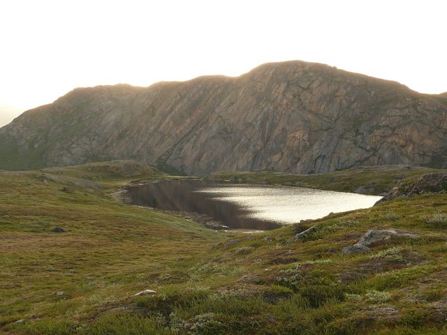
| P1 : The new track | P2 : Lake near the track | P3 : "Bulldozer Valley" |
| I stop to walk just before going down from the plateau. A female ptarmigan is on the trail. It is afraid but will not move. It's defending it's five chicken, emitting some discrete "Cot". I take several pictures of the family. |
|

I go down from the plateau and stop between the two next lakes, at a place indicated as suited for tents by the map.
9.00. I take a bath into the lake and wash me a bit.
11.00 I'm leaving, but with no motivation for walk. The weather is hot (this means that there are many flies...). I stop again 20 mn later and fall asleep during half an hour in the shadow of a boulder.
Along the following lake, walk begins to be difficult: no clear foot-path, each piece of path ends to a new bog, and the walk is done in 60 cm - 1m high willows... with the harassing clouds of flies turning around the head.
 |
Clouds are filling up the sky. At the end of the lake, a fine rain is falling. It is however welcome and makes the air a bit colder. I follow a last little lake and change the Pingu map for the Sisimiut map. I expect to sleep in the next hut, but this one is on the top of a little hill. No matter, I will sleep in the new one, the one that is not on the map, in the North of the lake. |
| P4: Clouds are filling the sky |
It's now raining hard. I put my raincoat on my bag to protect the cameras.
I find a ford to cross the river. At this stage, it is pleasant to walk into the water, which changes the water filling them.
After the ford, I see a hut that was not indicated on the map, on the other side of the river that I just crossed, near the "official" ford. I hope that this is not a mistake in the location of the hut I'm expecting, on the North side of the lake, 3 km farther.
I cross a group of 4 Americans very well equipped and amazed to see me with trousers completely wet (because of the willows), in shirt, sleeves rolled up under the rain, but the raincoat protecting the bag.
 |
 |
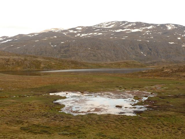 |
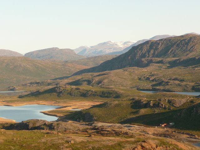
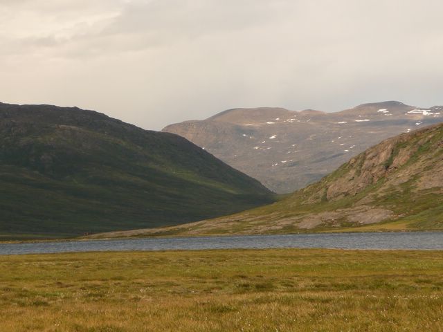
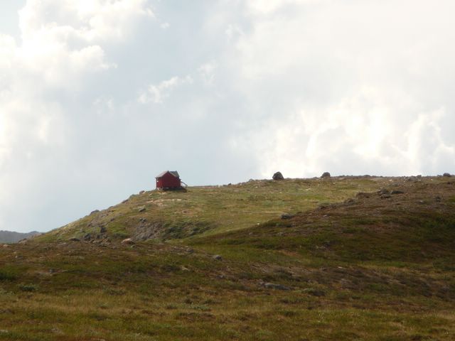
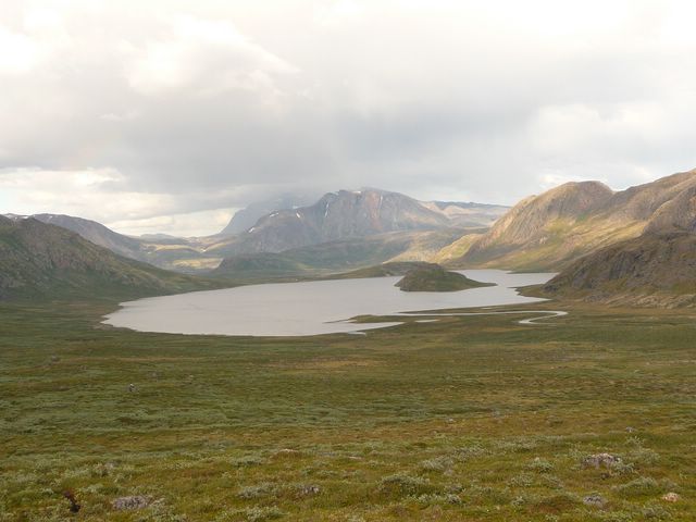
| P5: The hut mentionned on the map. | P6: The lake vieved from the West. | P7: Other lakes on the plateau. |
They didn't saw the hut in the North of the lake. Therefore, I will have to find the next one because I don't want to build the tent under the rain... Putting a wet tent into a bag makes a lot of useless water to be carried.
The next hut is located at about 10 km. I leave the lake, go on the next slope, passes several little lakes. The rain stops. Far away from me, a hiker is following me. He is singing an air of opera.
I stop to take pictures of raindeers, start again, and the hiker reaches me. He has an enormous bag and wears military clothes. However, he is not in the army. He shows me the raideers. He is in the countryside since 9 days. He was with friends but lost them; he also lost his map. He watch my map to locate the next hut.
|
|
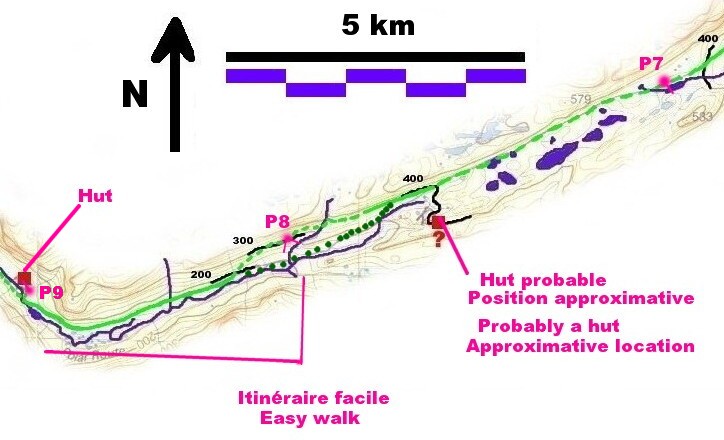
| P8: Nerumaq Valley. An easy, dry and well marked trail. |
Very rapidly, he overtakes me . He chose to follow the foot-path, and not the map or the cairns.
I'm looking for my way. A young raindeer takes the direction of the cairns. I follow it, takes some pictures of it, but the idea map/cairns looks difficult. I come back to the foot-path, knowing that I will not be able to find the next hut. But given that it is also a new hut, a new error in location is also possible.
I go on to the foot-path 200 m above and follows it.
21.45. I stop a short time to take a dinner. I begin to get the feeling that I don't know where I am. I continue to follow what looks like being a foot-path, but is in fact the path of raindeers.
My walk is stopped by a torrent. According to the map, I may be 2 km farther than what I thought. This would indicate that I walked quite faster than my (now classical) 1.5 km/h !
22.20. I open my bag to find my location with the GPS. X=0419407; Y=7434621. Actually, I am to the point I suspected on the map. This means that I'm to 6 km only from the next hut.
I cross the torrent, arrives in 1.5 to 2 m high willows, but the walk is paradoxically easy. I see two tents in the valley near a well marked foot-path on a little hill following the valley. This means that the foot-path my not cross bogs.
I go down in the valley and reach the trail. However, I'm now confronted to a new, and unpredicted difficulty. The walk is so easy and so fast that my feet (still in the wet socks) are warming. I cannot walk anymore.
I stop to dry my feet and take a rest. I begin to be sleepy. The next hut is now to 4 or 5 km.
1.00 I'm to the hut. I build the tent, because the hut is small and there is a lot of material outside it, indicating that many people are already inside. Moreover, another tent is mounted near the hut.
I go to the river, take some water and wash my feet in order to kill some invisible bacterias that begin to bait me.
I eat Chinese noodles and go to bed. It is 2.00.
 |
| P9: Do not disturb. Somebody is sleeping. |
Back to the "Trek main page", Day 1, Day 2, Day 3, Day 4, Day 5, Day 6